Groom Texas - Giant Cross with Stations of the Cross
The 190' cross at Groom Texas is right next to I-40 and is the product of one man's imagination and hard work. He happens to be Catholic and there are Catholic elements, but it is non-denominational and all are welcome.
The cross is ringed by the Stations of the Cross or Via Dolorosa (Way of Sorrows). They are very well done indeed.
Here, the condemned Jesus stands before Pilate as Pilate washes his hands. Jesus hands are bound, a detail often included in statues found in churches in Europe.
At the foot of "Calvary" is a depiction of the Last Supper.
The statue of Judas (at the end of the table) shows him with his hand in the purse as depicted in St John's gospel. The other disciples included are (L-R) Andrew, Peter, John, James). Christ (center) is breaking the bread made flesh at the first Eucharist celebration.
Here, Jesus dead body lay across Mary's lap reminiscent of the famous "Pieta" as depicted by Michelangelo in his incredible statue in the Vatican.
Behind "Calvary" is the tomb with the large round stone.
Inside, we find only the angel reverencing the place where Jesus had lain.
Palo Duro Canyon
After visiting the giant cross with the Stations at Groom, Tx, we backtracked slightly to Claude, Tx to drive the Palo Duro Canyon. Had some great Mexican food in Claude, then headed South. Palo Duro is touted as Texas' Grand Canyon. It is beautiful but it's a few thousand feet short of being as deep as the real thing.
The Palo Duro Canyon was cut by a branch of the Red River over the millennia. It is several miles across and is a beautiful drive. This area is either plateaus, as flat as a board, or gorges like this one - no in between!
Ever wonder why it's called the Red River?
This must rival the Mississippi for mud content!
McKenzie Lake is South of the Palo Duro Canyon and was well worth a short side trip.
The wind was just about strong enough to knock us off our feet!
After visiting these sights, we headed East again on I-40. Stayed at a very nice Holiday Inn on the North side of Oklahoma City Monday evening before driving on to Bob's sister Barbara and her husband Dave Neff just south of Lawrence for a nice relaxing week before finally heading home Saturday March 13!
Wednesday, March 10, 2010
Saturday, March 6, 2010
Valleys, and Canyons, and Chapels, Oh My!
Walnut Creek National Monument
On Friday, we arrived in Flagstaff mid-afternoon, checked into our hotel and headed for Walnut Creek Canyon National Monument. It's a good thing didn't unpack the car first since we arrived only 40 minutes before the Monument closed for the day! But we took a walk around the rim of the canyon and could see the ruins of the cliff dweller's homes. These homes were on the naturally occurring shelves formed by erosion and averaged only a few feet in depth!
Others dwelt atop the mesas in stone houses. These folks becameknown as the Sinagua people from the Spanish sin (without) agua (water) since they lived in an extremely arid environment with little water.
Oak Creek Canyon & Sedona
Saturday morning was brisk (30 degrees), bright, and sunny. We drove Arizona highway 89A down the Oak Creek Canyon, one of the most beautiful drives in the land of beautiful drives!
At the top of the canyon, there is an overlook that sets the stage for what is to come.
Native Americans (Navaho) were selling hand made items. We bought a beautiful silver "dream catcher" necklace, bracelet, and ear ring set as well as a turtle sculpture with a painting on the top of "the end of the trail" (where an exhausted warrior slumps atop his pony).
We learned that the canyon had been closed for quite a while due to rock slides and had just been reopened this week! Ever seen a canyon switchback with a traffic signal?
(As it happens, this was a blessing since later, traffic from "above" came in packs of 6-10 cars making dodging traffic easier while running up the road for a photograph!)
As the canyon unfolds, Oak Creek crosses the road several times and creates some truly breathtaking scenes.
There are many resorts and private cabins along the canyon, many of which can be reached only by driving across concrete fords (shallow water-covered concrete pathways barely wider than a vehicle!). This one also had a pedestrian bridge downstream a little, allowing residents to park on the road side of the creek and walk across if the water was too high to attempt the ford.
While we watched, this teenager drove cautiously across the ford. Then he jumped out and Dad BACKED across the ford! Why didn't he just go another 50 feet and turn around? Your guess is as good as mine! I was ready to switch to "movie mode" to capture it on film if he drove of the edge - but he made it OK.
Mile after mile of drop-dead gorgeous landscape!
And canyons with babbling brooks!
It's a good place to meet cute girls too!
(Maybe the babbling of the brook covers up my babbling? Could explain a lot!)
Near the bottom of the canyon, we reached Sedona. Imagine Nashville with a canyon and creek running through it! Lots of traffic and lots of "separation places" - places where you get separated from your money!
We saw this cactus flowering (remember the Walter Mathau, Goldy Hawn, Ingrid Bergman movie "Cactus Flower"?)
Holy Cross Chapel
As we reached the southern reaches of Sedona, we turned on a side street to get one more photo of one more beautiful rock formation (YAWN!!!) and happened on the Chapel of the Holy Cross!
With the cross resting on two rock outcroppings, this chapel literally took an act of congress (since the land was part of the Federal Reserve). It just celebrated it's 50th birthday!
As on the outside, the back-lit cross dominates the Chapel.
Just above the altar, mounted to the cross, is this sculpture titled "Anima Christi" or "Soul of Christ." This, of course, is the title (first line) of a famous prayer as well.
The Stations of the Cross were amazing! All simply Roman numerals, but fashioned from large spikes!
Just down the hill from the chapel is this little spread. When I asked the volunteer confirmed it was "some rich dude!" Notice, this little vacation home has an observatory dome, waterfall, and four car garage! The small house on the left is where we will stay when we are invited as guests.
As we drove south from Sedona, I just couldn't resist taking one more photo of just one more gorgeous rock formation! (Sorry! ;-)
The forecast for Flagstaff Saturday night was snow showers!
So in the finest snowbird tradition, once out of the Canyon, we headed east to Gallup, New Mexico where it might rain on us, but NO SNOW!
Tomorrow, Amarillo via Albuquerque.
Friday, March 5, 2010
The Strip - Las Vegas
If you can walk down the street and pass the Eiffel Tower . . .
The Statue of Liberty . . .
and the Sphinx and a Pyramid - You must be in Vegas!!
Where the MGM Lion dominates the lobby of the hotel . . .
As well as being one of the biggest attractions on the strip. (The live lions are only on display for 3-4 hours, then a new group takes over. There are over twenty lions in all.)
"New York Harbor" was empty leaving this poor fireboat (at the foot of the Statue of Liberty) high and dry!
Still have wander-lust? Just down the street you can visit Venice!
The Rialto Bridge spans a street instead of the Grand Canal and ends at the foot of the Bell Tower of the Basilica of St Mark.
We took the outside gondola ride and had a wonderful time. Our gondolier had a great voice and sang to us in Italian! (In case you can't tell, the Venetian is one of our favorite Vegas destinations.)
Inside, we strolled the "inside" canal to the Piazza San Marcos - a miniature version to be sure.
Soon a troupe of very talented performers entertained with Italian opera, juggling, and pantomime.
At dusk, we ate very tasty slices of pizza at Treasure Island, then moved outside to see the show where pirates . . .
Are lured to their doom by some pretty sexy sirens! In the end, the gals won and the guys resigned themselves to a life of service and slavery. All in all, a pretty good show!
We then walked down Las Vegas Blvd. to the Mirage for the volcano show.
This photo shows kind of the high spot of the show . . . now, just beat a big drum and stand in front of an open oven (for the heat) and you'll get the idea. Hardly worth the effort of getting there.
From there we walked to the Bellagio for the Dancing Waters show.
We've been fascinated by Dancing Waters since we first saw it on the stage of Elliott Hall of Music at Purdue in the 60's (not quite this big, but it big for a stage).
This show does not disappoint!
Can't make it to Rome, just go to Caesar's Palace for their Trevi Fountain (this one is in the round, unlike the real one in Rome. We couldn't help wondering if an Anita Ekberg lookalike (La Dolce Vita) would wade in this one! (Sadly, not that we saw!)
Our wish? To make it back in another six years (or less), but for now, to make it home safely.
Tomorrow, Flagstaff and the Sedona Canyon Drive!
Thursday, March 4, 2010
Mountains, High Desert, and Lakes Near Las Vegas
Mount Charleston
With a short one hour drive from Las Vegas, you can be skiing, snowboarding, or just playing in the snow! The turnoff to Mt. Charleston is only 35 miles Northwest on a nice four lane highway. Another 25 minutes up the mountain, you are romping in knee deep snow.
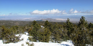
This scenic overlook gives a great view of the valley floor below. To the left of the small brown peak is Creech Air Force Base where Predator remote piloted vehicle operations are conducted.
This shot is from the trail head leading to the overlook just mentioned.
The views from the mountain were spectacular whether looking up or down the mountain.
This campsite had quite a few campers just playing in the snow!
The top of the road was at the parking lot for the ski area.
This person is downhill skiing but it seemed a lot of the activity was on snowboards.
Valley of Fire
Leaving the mountain, we drove back into Las Vegas, across the loop at the North end, and then Northeast 25 miles to the Moapa River Indian Reservation and the Valley of Fire.
This valley is loaded with rock formations rich in iron and consequently extremely red.
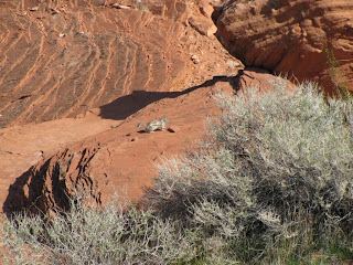
Other areas show the variety of chemicals (and colors) in the rocks in the area.
Cliff dwellers left these petroglyphs describing hunting with the atlatl - an instrument used to launch a spear.
The area has many formations such as this loop formed by wind erosion.
And of course, there is a lot of wildlife.
Lake Meade
A short drive out the East entrance of Valley of Fire is Lake Meade - or what's left of it!
This panoramic view shows the lake - imagine a lake 25% longer and much wider. We were shocked at how low the water is!
We drove to Overton Beach only to find no water at all! This boat had been abandoned and vandalized. The lake will have to rise 20 feet or more to float this boat.
This is the boat ramp! It is probably 200 yards long and ends well short of the trickle that is the Colorado River!
Driving down the lake a few miles, we found an overlook where we could see how bad the situation is. You can see island at the right near shore that should be 25 feet under water!
As we drove South, we encountered dozens of work sites where they are widening and repaving the road. In the meantime, several areas require driving through stretches of gravel.
That, along with our travels in the desert meant a trip to the car wash!
Tomorrow, we "do the strip!"
Subscribe to:
Posts (Atom)